 |
|
About .. .. ..... . . . .Partners. . .... . . .. .... Methods ... . . .. . . ... Data . .. ... .. .. . . Results |
|
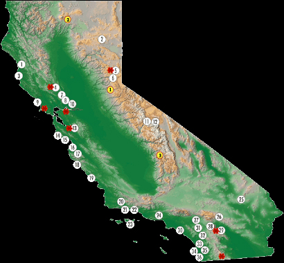
Map of California. White circles = UC Natural Reserve System. Yellow circles = Fire & Fire Surrogates Study Sites. Red stars = Target sites of historical collecting that will be the targets for the current work. |
Data from the CalBug project is stored in an open-access online database.
Each collaborating institution continues to develop techniques and workflows for data acquisition that best fit their collections and resources. Data are then aggregated in a central cash. As data acquisition continues over the life of the project, not all data from all institutions have yet been aggregated into the central cache. Search the database: Simple Query, Advanced Query Data Fields: A summary of Darwin Core compliant data fields collected for CalBug Progress: Spreadsheet of proposed taxonomic groups and progress Georeferencing: A guide to georeferencing drafted by Doug Yanega (UCR) Sources of Error: A working document of bias and error, edited by Kip Will (UCB)
|
Map of georeferenced specimens in the CalBug database of the Aphid genus Aphis in the Berkeley, California, area (Berkeley Mapper).
|
|
Updated May 2013. For questions or comments please contact Peter Oboyski |
|
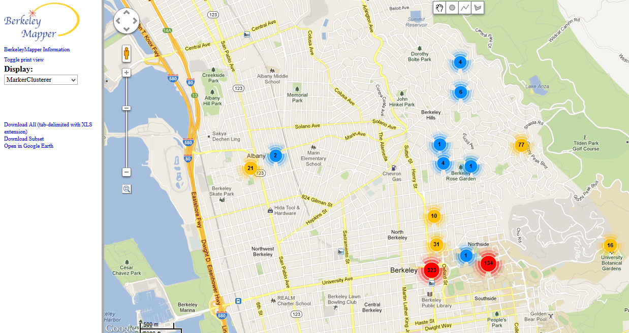
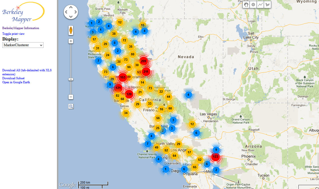 Map of georeferenced specimens in the