Our research experience lies in the broad areas of remote sensing, and data assimilation for improving land surface hydrology. Multi-satellite assimilation and modeling platforms provide robust and complete land surface datasets (i.e., hydrology, energy, carbon fluxes). These platforms build a comprehensive description of the earth processes that is geared toward accurately representing the complexity of natural and anthropogenic interactions in land surface processes. Most importantly, these platforms are suitable as decision support tools for applications across different aspects of earth system science.
Current Projects
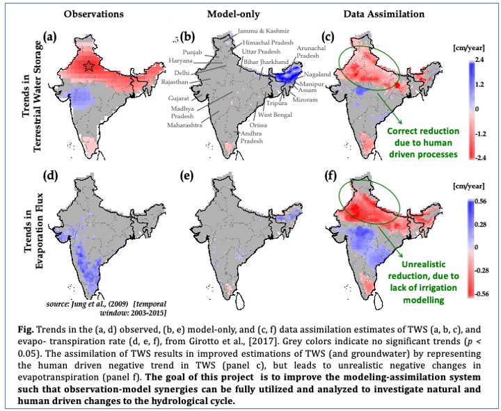
Terrestrial Hydrology Program, NASA (2020-2023): “An improved understanding of human-driven changes to the hydrological cycle via multi-variate assimilation of soil moisture and terrestrial water storage”
A remaining challenge of hydrological data assimilation is to operate within physically realistic models so that the true observational features (e.g., included human driven processes) are not excluded during data assimilation of satellite observations. This project aims at 1) improving land surface model physics by explicitly introducing existing irrigation schemes; 2) applying multi-variate (soil-moisture and terrestrial water storage) data assimilation schemes; 3) analyzing the multi-variate assimilation results to understand changes in the hydrology caused by both anthropogenic and natural hydrologic processes.
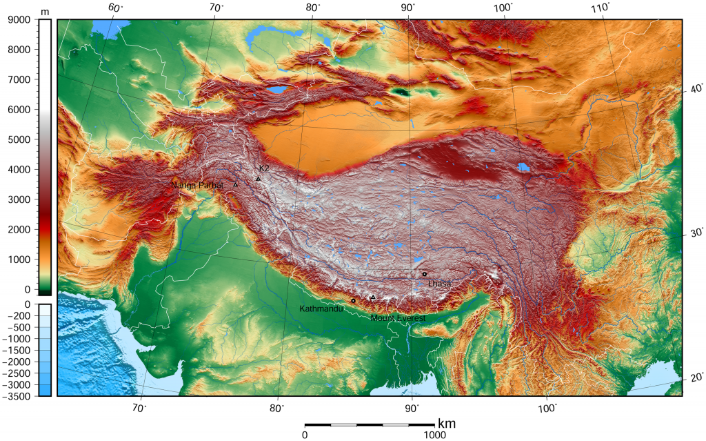
High Mountain Asia Program, NASA (2020-2023): “Subseasonal to Seasonal Forecasts in High Mountain Asia: Improving forecast skill for water resources and hazard management”
Management of water supply and hazard risks in this region is tied to the ability to forecast variations in the hydrologic cycle at spatial resolutions that reflect local and regional differences. However, such predictions are difficult due to the complex interplay among atmosphere, ocean, and land processes and the influence of orography on precipitation and runoff patterns. The objective of this project is to develop improved forecasts of precipitation, snow accumulation, snow and glacier melt, and runoff for the High Mountain Asia (HMA) region several weeks to several months in advance. This project incorporate land assimilation and downscaling improvements into the NASA subseasonal-to-seasonal (S2S) forecasting system to constrain the role of land-atmosphere interactions on meteorological and hydrological forecasts across HMA. Project website: https://www.himat.org
Sea Level Change Science Team, NASA (2020-2024): “Combining multi-satellite observations, modeling and Earth system data assimilation for understanding observed and projected sea level change”
While the main causes for sea level change are linked to ice melt and ocean thermal expansion, the contribution of hydrology (via river streamflow) has the power to affect the regional inter annual variability of the sea level. In general, global land surface models includes hydrologic response to climate driven processes (i.e., hydrology changes driven by precipitation, temperature, solar radiation), but anthropogenic processes (i.e., groundwater extraction, irrigation, impoundment in reservoir) are not yet modeled or assimilated in the reanalyses. To improve estimates of sea level rise we need to 1) improve model estimates of land hydrology by including both human and natural driven processes; 2) characterize their magnitude and uncertainty; 3) quantify land hydrology contribution (and uncertainty) to changes in the sea level. This improved estimation can happen via assimilation of satellite based terrestrial water storage and soil moisture observations. Team webpage: https://sealevel.nasa.gov
Subseasonal-to-Seasonal Hydrometeorological Prediction, NASA (2023-2026): “Hydrological Predictability and Prediction Skill Associated with Agricultural Practices“
Soil Moisture dynamics contribute to the accuracy of sub-seasonal to seasonal forecasts. While natural processes driving soil moisture dynamics (such as precipitation-induced soil wetting) are included in global atmospheric circulation models, anthropogenic processes (such as irrigated agriculture) are rarely modeled. The impact of irrigation on soil moisture variability and soil evaporation depends on the irrigation technique. Innovations in irrigation infrastructure have allowed humanity to utilize previously inaccessible water resources, irrigation techniques, and planting practices to enhance agricultural productivity, often converting rain-fed croplands to irrigated lands. While agricultural intensification is a promising approach to meet the increasing food needs of humanity, it is still unclear to what extent the expansion of irrigated areas, and the related agricultural practices will affect the local, regional, and global climates via teleconnections across temporal scales.
Our primary hypothesis is that an improved representation of land atmosphere dynamics can be accomplished if irrigation processes are explicitly coupled within current state-of-the-art Earth Modeling Systems. Specifically, we hypothesize: H1) The explicit representation of agricultural practices allows for improved forecasts skill of the NASA sub-seasonal and seasonal models. H2) Through land-atmosphere feedback, agricultural practices may alter the local precipitation regime at the sub-seasonal and seasonal timescale, thereby locally changing the irrigation water needs and availability with the potential to reshape the distribution and extent of areas suitable for irrigation. This feedback may involve teleconnections between irrigation in one region and hydroclimatic conditions in another region.
To assess predictability and influence of irrigation practices, we propose to use both observations and model analyses. We will introduce an irrigation scheme in the existing GEOS Subseasonal to Seasonal (GEOS-S2S) modeling frameworks. By introducing the anthropogenic influence on the boundary layer regulating land-atmosphere feedback, we aim on improving S2S forecasts skill. We propose to analyze variables that might be influenced by irrigation practices (e.g., land surface temperature, soil moisture, evapotranspiration, and precipitation) and are readily available from satellite derived products. We will also carry out regional teleconnections assessment of forecast predictability due to the inclusion of agricultural practices. This will be done using statistical decomposition analysis on the ensemble of produced hindcasts.
| Figure 3. Main types of irrigation technology, including surface (left), sprinkler (center), and micro (or ‘drip’) irrigation (right) (Photo source: Wikipedia, USGS, and PIs). These technologies determine the frequency and volume of irrigation water applications as well as soil moisture variability and soil evaporation, thus have potential to alter land-atmosphere interactions. |