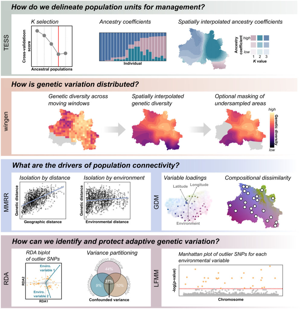
A Landscape Genomic Analyis Toolkit in R (algatr)
We developed A Landscape Genomic Analysis Toolkit in R (algatr) to provide a step-by-step, start-to-finish pipeline to perform core landscape genomics analysis methods on genomic datasets. The algatr package includes methods for performing analyses of population structure, genetic diversity, spatial genetic differentiation, and genotype-environment association (GEA) on genomic data collected under individual-based sampling schemes.
More details on the algatr package are available from the algatr GitHub repository.
The algatr package can be installed using the code: devtools::install_github(“TheWangLab/algatr”)
Citation: Chambers, E.A., Bishop, A.P., & Wang, I.J. (2023). Individual-based landscape genomics for conservation: an analysis pipeline. Molecular Ecology Resources.
Multiple Matrix Regression with Randomization (MMRR)
MMRR provides a method for quantifying and disentangling the relative effects of isolation by distance (IBD) and isolation by environment (IBE). In practice, this method can be extended to quantify the relationships between any number of explanatory variables that can be represented as distance matrices and a given response variable (e.g. genetic distances).
R code and a brief tutorial: MMRR tutorial
Dryad entry: MMRR function R script
MMRR is also available as part of the algatr R package.
Citation: Wang I. J. 2013. Examining the full effects of landscape heterogeneity on spatial genetic variation: a multiple matrix regression approach for quantifying geographic and ecological isolation. Evolution, 67: 3403-3411. [pdf]
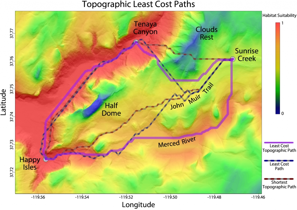
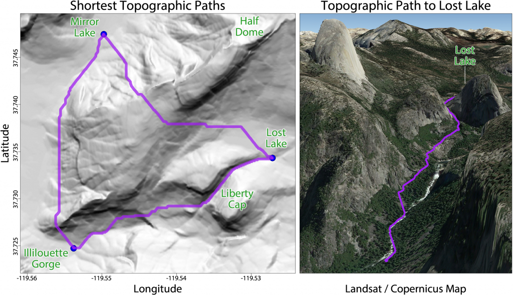
Topographic Distances (topoDistance)
The topoDistance package provides tools for finding shortest topographic paths and topographic least cost paths in R.
Topographic distances are calculated by weighting the edges of a landscape graph by the hypotenuse of the horizontal and vertical distances between raster cells and then finding the shortest total path between nodes of interest. The package also includes tools for mapping topographic paths and plotting elevation profiles.
topoDistance is available on CRAN: https://CRAN.R-project.org/package=topoDistance and can be installed using install.packages(“topoDistance”)
You can download the user manual for topoDistance by clicking here.
You can also view the topoDistance vignette for help getting started.
Citation: Wang I.J. (2020) Topographic path analysis for modeling dispersal and functional connectivity: calculating topographic distances using the topoDistance R package. Methods in Ecology and Evolution, 11: 265-272.
Mapping Genetic Diversity (wingen)
The wingen R package provides new methods for generating continuous maps of genetic diversity using moving windows with options for rarefaction, interpolation, and masking.
More details on wingen are available from the wingen GitHub repository.
The wingen package can be installed using the code: devtools::install_github(“AnushaPB/wingen”)
Citation: Bishop, A. P., Chambers, E. A., & Wang, I. J. (2023). Generating continuous maps of genetic diversity using moving windows. Methods in Ecology and Evolution, 14, 1175–1181.

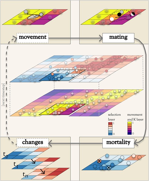
Individual-Based Landscape Genomic Simulations (Geonomics)
Genomics is a Python package for performing complex, individual-based, forward-time, spatially explicit, landscape genomic simulations with full spatial pedigrees that is highly customizable and extensible.The flexibility of forward-time simulation makes it especially valuable for understanding the drivers of spatial patterns of genomic diversity because it allows for the simulation of arbitrarily complex scenarios in a way that mimics how real populations evolve.
More details on Genomics are available from the Geonomics GitHub repository.
The Genomics package is freely available from the Python Package Index (PyPI).
Citation: Terasaki Hart D.E., Bishop A.P., and Wang I.J. (2021) Geonomics: forward-time, spatially explicit, and arbitrarily complex landscape genomic simulations. Molecular Biology and Evolution, 38: 4634-4646.
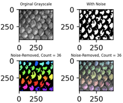
Automated Scale Counts (ScaleCounter)
ScaleCounter is a Python package that uses a machine learning algorithm to generate counts of animal scales from specimen images. The count data generated by ScaleCounter have been validated against manual counts for a variety of fish and lizard species.
ScaleCounter is publicly available on the Python Package Index (PyPI).