The Irrigation Planner
What is it?
The Irrigation Planner is a free, simple-to-use computer program developed by the University of California Cooperative Extension that allows you to create and explore hypothetical irrigation scenarios for your property. It can be used for planning irrigated pastures, wetlands, or irrigation ditch placement.
With the Irrigation Planner, you can:
- Display to a digital map of your property.
- Place irrigation water release points of any amount of water.
- Modify the landscape by adding or removing channels that direct water flows or barriers that block them.
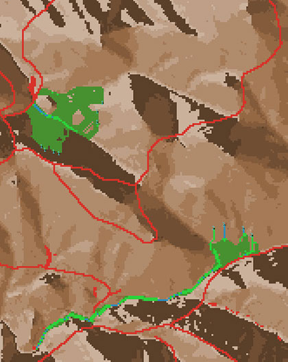
- See how your irrigation setup would flow across the landscape and what acreage of pasture, wetlands, and open water would be created.
You can see a brief example of the planner in action in this tutorial.
The Irrigation Planner program is designed to be easy to use, but customizable enough to be able to be adaptable to plan for real landscapes. The flows of water and wetland acreages estimated by the Irrigation Planner are designed to be supplementary tools, and are not guarantees of the real effects of releasing water from any given point. Before attempting to release water on your property, there are a few important limitations to the estimates produced by this program to consider.
Irrigated pasture & wetlands benefit both people & wildlife
The application of water to hillslopes not only can create forage for domestic animals and green space for fire protection, it also has the co-benefit of often creating wetlands in valleys and other areas of high water accumulation. These wetlands can not only enhance the aesthetic value of a property, they can also attract wildlife. Though often small, they still attract a great number of bird species, including a unique local population of the rare California Black Rail, Green Herons, Wilson's Snipe, Common Yellowthroats, Belted Kingfishers, Yellow Warblers, and more. We've often been asked by landowners: How can we make a wetland on our property? How much water do we need and where should we release it? The answers to these questions are complex, depending on the topography and soils of the property. This tool can provide guidance in exploring the effects of irrigation water release onto your property and estimating the amount of pasture, wetlands, and open water that could be created.
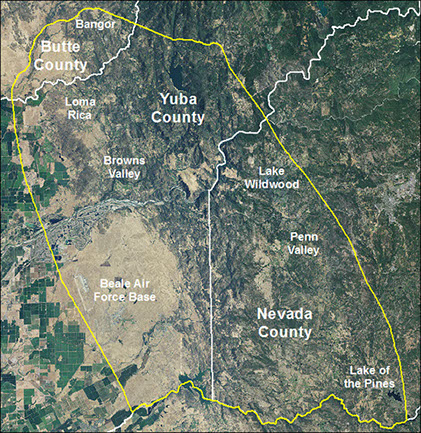
Coverage area
The Irrigation Planner is available for the foothills of the Sierra Nevadas for Yuba, Nevada, and the southern tip Butte county (yellow outline on the map to the right). You can look up whether your parcel is covered here:
Future additions
The Irrigation Planner is still under active development! Future versions will have expanded features including estimates of the probability of bird species’ presence, change in mosquito abundance, and change in West Nile virus risk under different wetland scenarios.
Interested in the technical stuff? Here’s how our model works.
Have questions or need help? Contact vanschmidt@berkeley.edu.
This tool was developed by Nathan Van Schmidt, Sam Sandoval Solis, Roger Ingram, Cass Mutters, Van Butsic, and Steve Beissinger, and funded by the University of California Cooperative Extension. Special thanks to all the landowners who provided feedback and data.
DOWNLOAD
v1.0
The Irrigation Planner runs on NetLogo, a program for scientific models developed by Northwestern University. To use it you will need to download and install the latest version of NetLogo, available for free from here.

Updated May 13th, 2017