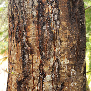
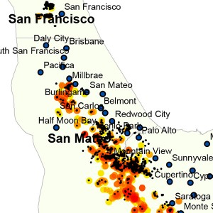
When looking at SODmap, you may wonder if P. ramorum-positive trees are close enough to pose a threat to trees on your property. Use the free App SODmap mobile to get the answer. Just tap the App risk function and it will tell you whether infected trees trees are within 200 m (high risk) or 1,000 m (moderate risk). If infected trees are further than 1,000 m, risk is typically low. Alternatively, you can use Google Earth, tapping the icon with a “ruler” on the top bar. Click your mouse on the closest infected tree and then move the mouse to your property. Be careful to actually move the mouse all the way to an oak tree within your property. The mouse should be drawing a line when you go from the infected tree to your oak. When you click the mouse again on top of the oak on your property, the ruler will tell you the distance. The following is suggested:
- As the crow flies, measure from any infected tree to any oak of interest.
- Repeat the measurement process using 3 different infected trees that appear to be close to your property.
- If distance is slightly higher than 200 m (high risk) or 1,000 m (moderate risk), but your property is downhill and/or downwind, you may still consider your oaks to be at risk.