
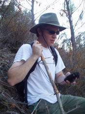
The project’s goal is to compare a vegetation survey of plots in and around Mount Diablo conducted by the US Forest Service in the 1930s to a modern survey of the same plots and determine what vegetation changes, if any, have occurred. Although it may seem like a simple idea, the project was full of challenges that required innovative methods and modern technology. For example, the maps used by the original survey in the 1930s were drawn in 1896, making it difficult to locate the plots today.
To locate these needles-in-the-haystack of Mount Diablo, Dingman used GIS, or geographic information system technology, to find the aspect, or direction the land is facing, and steepness of the slope of the land. He then arranged this data into digital elevation model maps and compared the topography of the old maps to these digital elevation model maps. He was able to use algorithms and the process of elimination to determine the location of the plots. When he conducted vegetation surveys, he found that most of the vegetation is relatively young- around thirty years old- due to stand replacement. The implications of his research mainly impact the park’s forestry service and fire control in the area.
Dingman continues to collect research in the Mount Diablo area and hopes to expand into the Sierras this summer. He says, “This project has provided me with additional skills needed to continue my research in graduate school next year, hopefully at Berkeley.”
- Stephanie Ludwig