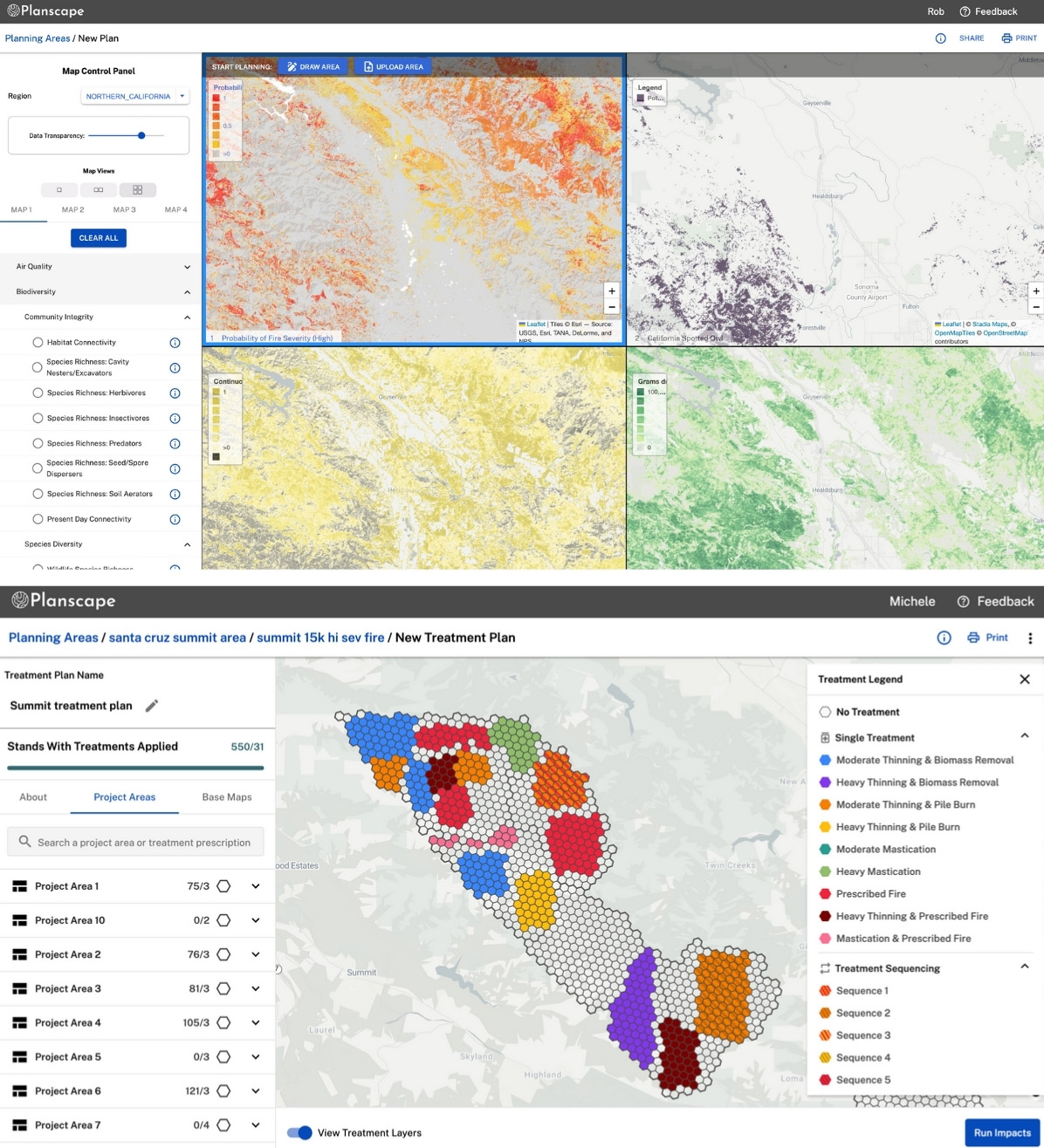
The Planscape application in November 2024.
Planning the fuel treatments needed to mitigate the impact of wildfire across the country—even in California’s highest-risk landscapes and communities—is about to get easier thanks to a collaborative, open-source tool developed with the help of University of California scientists.
Billed as a powerful decision support tool, Planscape empowers local governments and organizations to take control of their wildfire preparedness. State and federal data are combined with simulation and optimization models to make it easier for fire-safe councils, county governments, and other local organizations to access, visualize, and analyze data needed to plan landscape-scale hazard reduction projects while protecting biodiversity, watershed health, and carbon storage.
“The only sustainable solutions to wildfire mitigation are those with community buy-in,” said John Battles, a professor in the Department of Environmental Science, Policy, and Management (ESPM) at UC Berkeley who advised the project’s development. “Planscape was built to support these community-led efforts.”
Since 2021, Battles has served as co-chair of the California Wildfire & Forest Resilience Task Force’s science advisory panel. In support of the need for science-based decision making, the panel provided an independent review of the regional resource kits, an integrated framework of data, and tools developed by the Task Force to inform wildfire resilience in each of the state’s four diverse biogeographical regions.
A new platform
Work on Planscape began in 2022 when the California Natural Resources Agency (CNRA) approached Google.org, the company’s philanthropic arm, for help in turning the data and tools the Task Force developed into a user-friendly platform for land managers. Battles worked with UC Irvine professor Mike Goulden and UC San Diego data scientist İlkay Altıntaş to introduce the engineering and software teams to relevant scientists and agency personnel, vet the data and algorithms, and provide insights into the workings of wildfire and landscape management in California. Ongoing development is stewarded by the Spatial Informatics Group (SIG), a geospatial analysis consulting firm co-founded by three ESPM alums, with contributions from the US Forest Service and the USDA California Climate Hub.
“Planscape represents the intersection of science, technology, and community empowerment," said David Saah, PhD ’04 ESPM, a professor at the University of San Francisco and one of SIG’s co-founders. “By integrating robust data, government-backed models, and local priorities into a single, accessible tool, we’re equipping communities and land managers with the resources they need to address wildfire resilience effectively and sustainably.”
The platform officially launched in September 2022 and has since been used by public agencies, private organizations, and tribal groups to plan more than 300 wildfire resilience projects in California. “Before this, they would have to cobble together data and analytics from five or six different sources to get a comprehensive picture of their region,” Battles said.
A commitment to open science
One of the key features of Planscape is its commitment to open data and open science, which Battles said aligns with the University of California’s spirit and mission. The tool itself is free to use, and all data, science, and code used in the platform are freely accessible. “This platform is a testament to the power of collaboration and the transformative impact of open science,” Saah added.

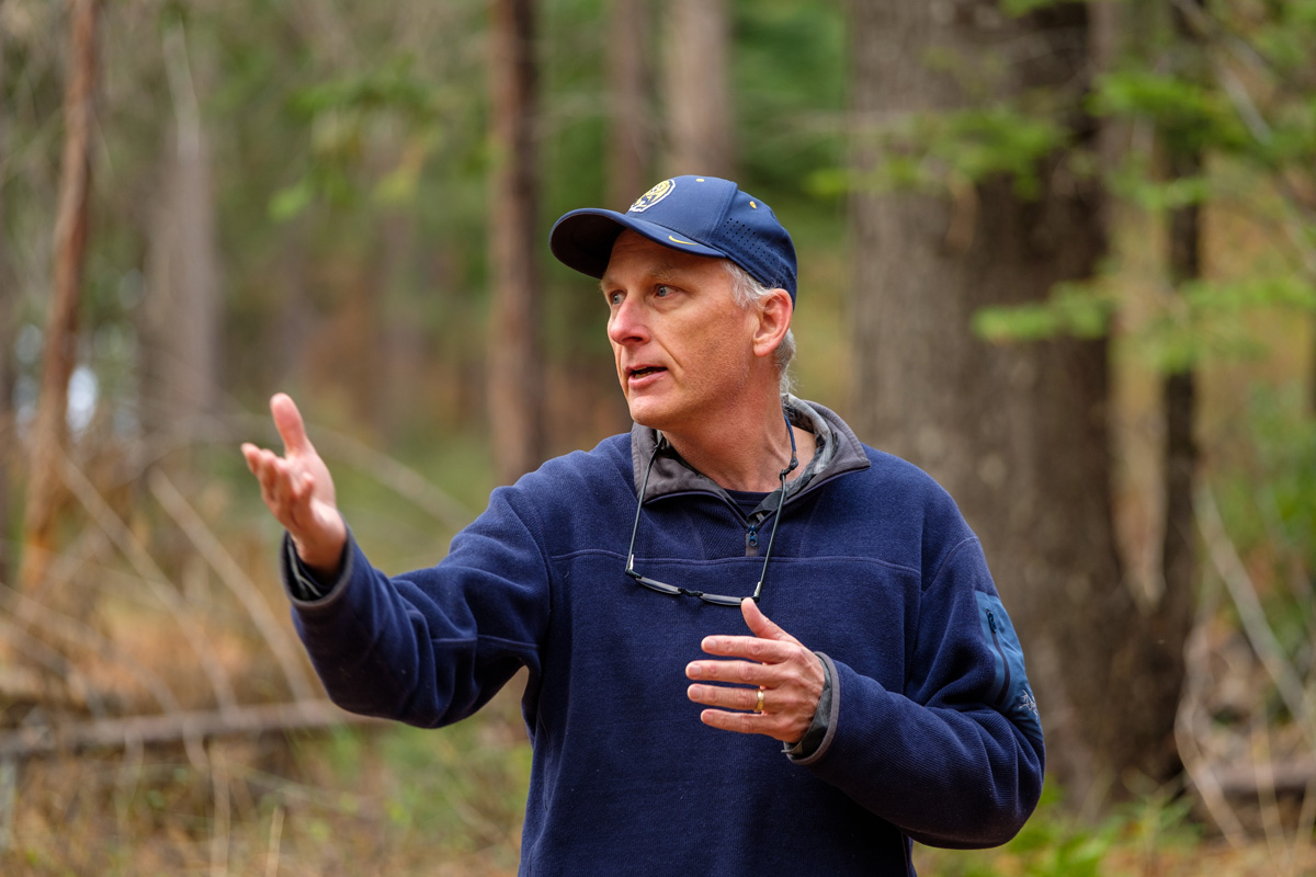
John Battles at Blodgett Forest Research Station in 2021. Photo copyright UC Regents
The platform also helps to foster trust within the communities it aims to serve by helping its users clearly understand the trade-offs associated with certain wildfire resilience treatments. "Putting a fuel break near a community might reduce their overall wildfire hazard, but it is done at the cost of potentially reducing the biodiversity of birds," Battles said. “We wanted the platform to show all outcomes so local decision makers can plan a path to resilience that reflects the priorities that are relevant to their communities.”
Beyond its direct applications, Planscape serves as a valuable educational tool for those who want to learn more about land management. Students in Battles’ capstone Forest Ecosystem Management and Planning course use the platform to simulate a local land management group and prepare a resilience planning document. “They work through the entire analytical process, balancing ecological and geographic considerations with the governance and social dynamics of these communities,” he said.
Project developers plan to expand Planscape nationwide in early 2025. Hundreds of additional data sets—including those from the USFS Climate Risk Viewer and the US Forest Service Raster Data Warehouse—will be integrated into the platform. “We’re excited that Planscape is making our science, data, and modeling products more accessible and easier to use for landscape planning and wildfire mitigation,” said Mark Finney, PhD ’91 Wildland Fire Science, a research forester at the Forest Service’s Rocky Mountain Research Station and member of Planscape’s governance team.
Specific data tailored to ecosystems, geographies, tribal lands, and private territories will be added as the platform grows, and users will also have the flexibility to incorporate their own datasets.
